

Video
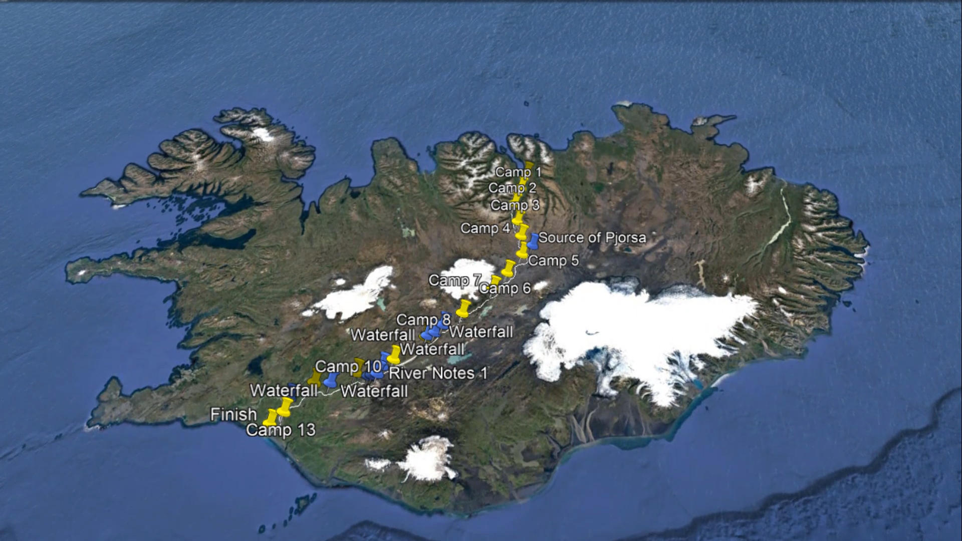
River Guide
This packrafting source-to-sea descent of the Pjorsa was undertaken in June 2017. All notes are based upon the conditions experienced at the time. We understand we had average water levels for the season. It is our understanding that the river flow below the dams near Burfell is regulated to 300 cumecs all year round.
Along the length of the Pjorsa there are long stretches of flat water or easy rapids. However, with the exception of the lakes and the final part of the river after Uridafoss there is always a fast current to help speed the paddler along.
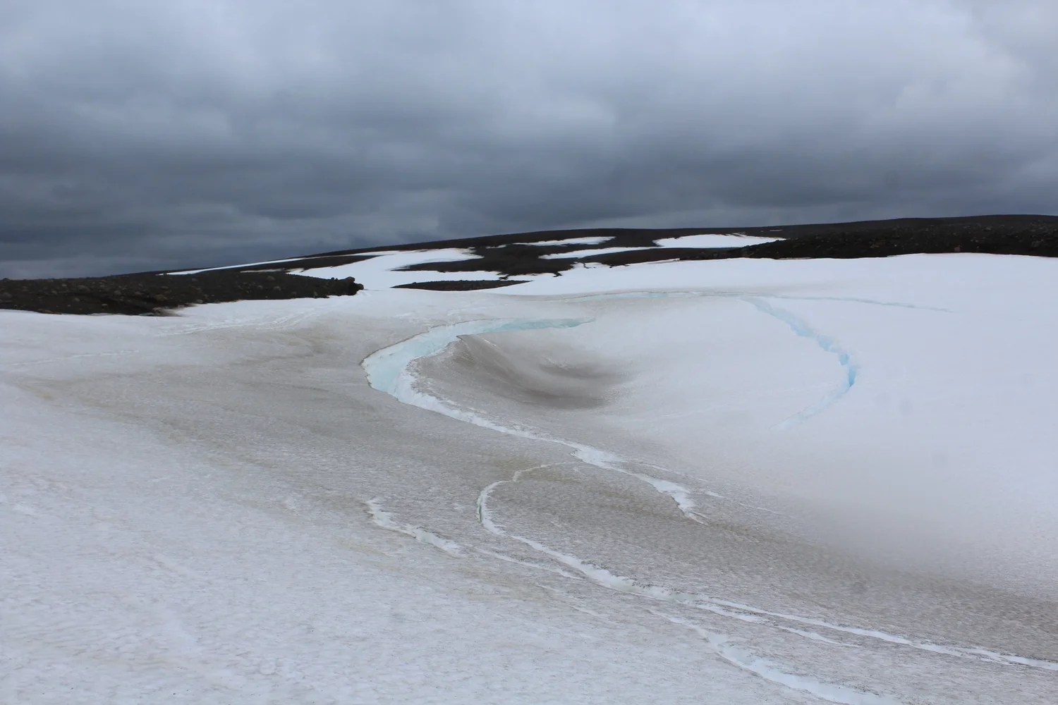
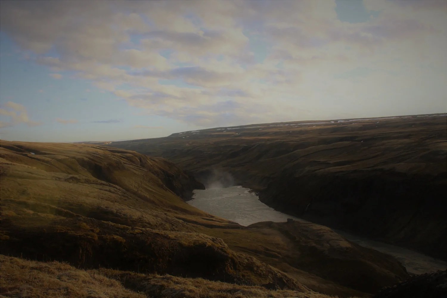
The source of the Pjorsa is a stream feeding a small lake at 64.984431° N, -18.023638° W. In June 2017 this stream was a snowfield but, in any case, is unlikely to be navigable at any time. For 15km from the lake outlet to the confluence with the river at 64.918000°N, -18.161281°W, the river is mostly unnavigable. Our team attempted to paddle part of it but regularly had to drag or carry boats around shallow areas – we would recommend ‘portaging’ this whole section unless water levels are much higher. A few kilometres from the lake outlet a spectacular mini-canyon cuts into the barren landscape with jagged rock formations and snow bridges waiting to great the adventurous paddler. The canyon contains four drops of various sizes (from around one metre to several metres). Unfortunately for three of these drops the entire river sumps underneath snow bridges, forcing (easy) portages. Due to the snow cover in June 2017 it was difficult to assess the feasibility and difficulty of the drops as only the exit pools could be easily inspect (sometimes only by paddling back upstream underneath the snow bridges!). This gorge could potentially make an interesting short paddle and deserves further investigation in warmer/wetter conditions.
For the 35km from the confluence to the lake the river is often flat with intermittent rapids up to grade 2/2+. One exception to this is a grade 4 rapid (64.893749°N, -18.217254°W) with a rocky landing approximately 4 km after the confluence. This rapid is much harder than anything else in this section and so its approach should be obvious. It is important to stop well above the entrance rapid as steep banks would make inspection or portage difficult lower down.
The southern end of the lake is dammed and there is no appreciable flow below it. This part of the river is also fenced off and so presumably access is prohibited, although it would be easy enough to follow on foot. An alternative is to paddle a man-made channel on the eastern side of the lake to a second smaller lake. From the southern end of this lake it is possible to trek 3 or 4km west, crossing the road near an emergency shelter, back to the main river. Accessing the river at the closest point (i.e. shortest trekking distance) is coincidentally just about where it becomes navigable again. To access the river here still requires that a fence is crossed, alternatively the fence line can be followed for at least several kilometres until it permits ‘natural’ access to the river.
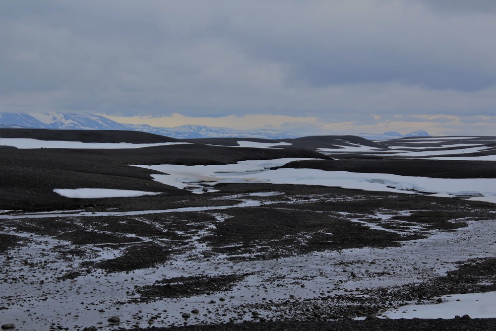
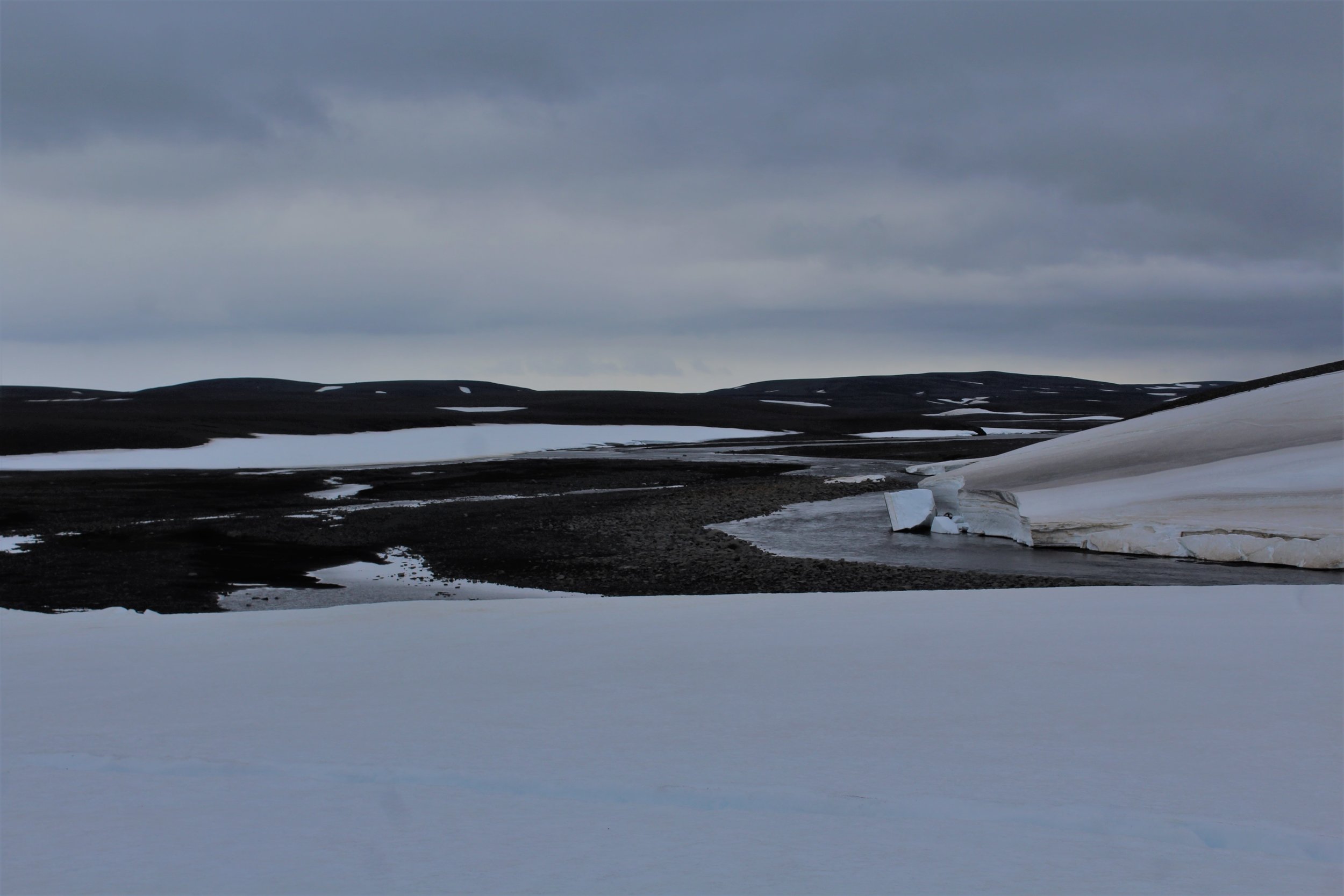
For the next 25km the river is flat and split across many channels. In many places the river is scrapey but with good planning (and a little luck!) dragging or portaging the boats can be avoided – a good rule of thumb seems to be to always take what appears to be the most voluminous channel! As you continue downstream the river gradually increases in volume as the many channels begin to merge together. As this happens the crystal-clear water of the upper river gradually turns a silty grey, a symptom of the glacial run-off.
At 64.458889°N, -18.962275°W the river splits around an island. The river right channel goes at G3. Shortly afterwards at 64.416781°N, -19.053645°W a grade 4 rapid appears. In low water you can climb out on the rocky ‘bank’ (it’s actually part of the river and is likely to have a small amount of water running over it) to inspect. In these conditions the water all funnels river right dictating the line – in higher water more lines would open up but inspection would be harder.
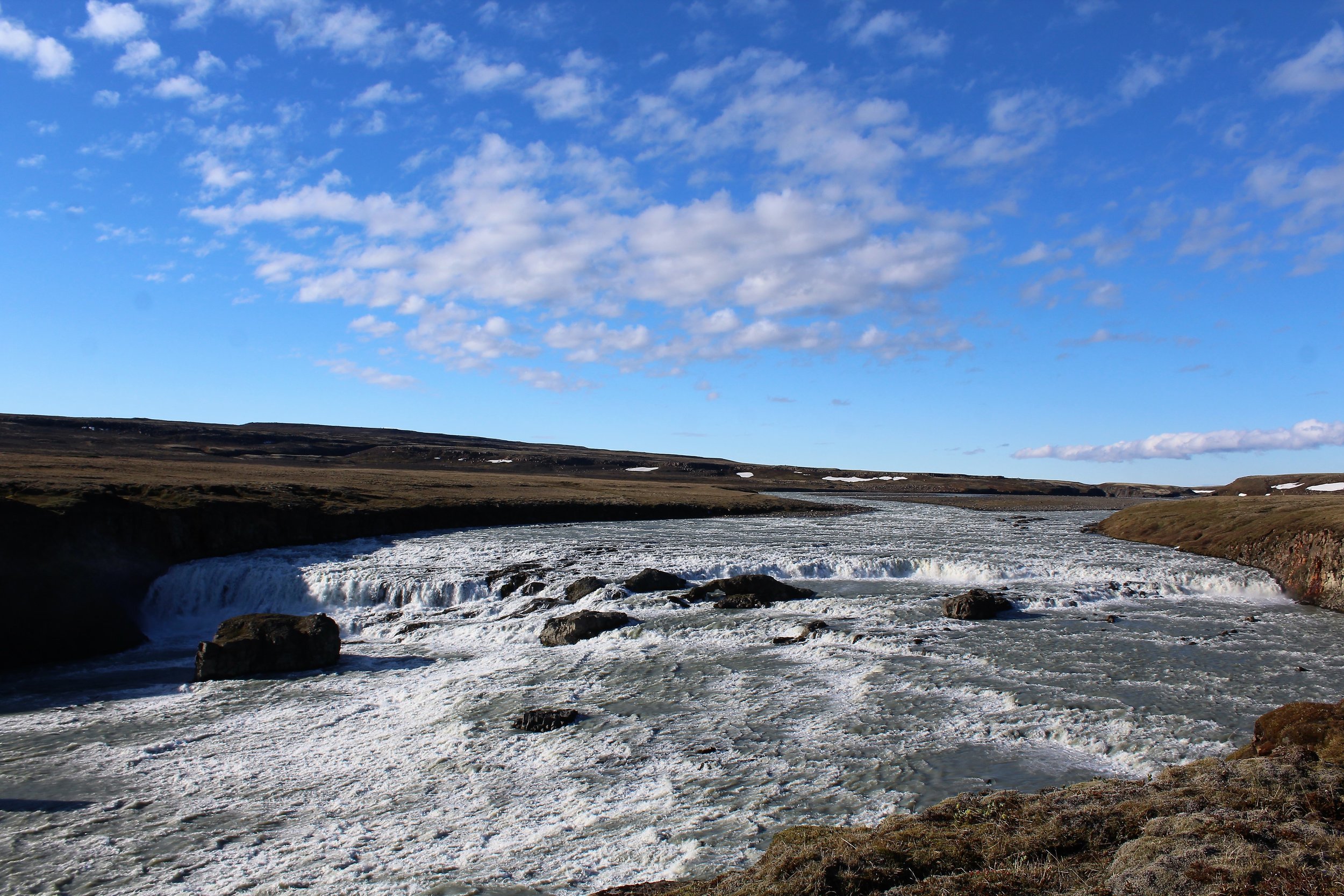
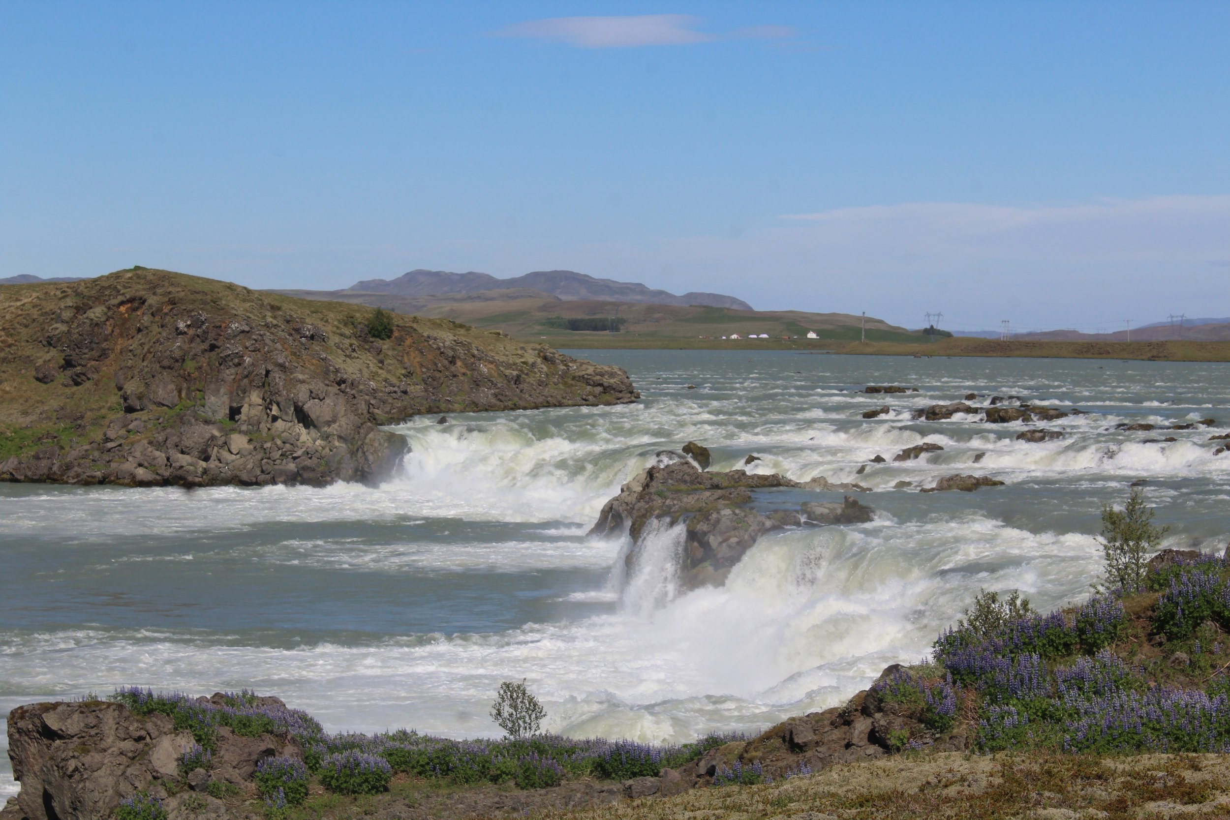
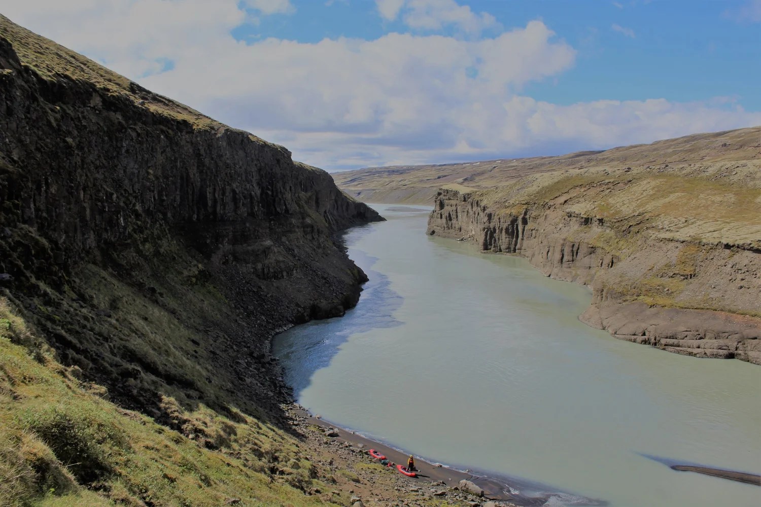
At 64.391668°N, -19.099013°W is the first waterfall (4km from grade 4 rapid), can be run via various lines. Then another 4km to where river splits (64.359554°N, -19.154802°W) around an island with hard rapids (Grade 4-) on both sides. The 2 channels converge temporarily before almost immediately splitting again, stay river left and get out partway down this next channel – you’ll probably want to portage the next waterfall. After this waterfall there are some decent looking rapids in a deep canyon – access is difficult so it is probably easiest to portage approximately 5km past the next waterfall. After waterfall 3 rivers calms down to flat.
The next 7km to the lake are flat but very scenic. Be careful of sandbars near the start of the lake. Near the dam on its west bank you’ll see a small innocuous whirlpool on the surface – stay well clear (when you get back on the other side of the dam you’ll see what I mean!). On the other side of the dam pick a spot to put back on depending on your ability. The river gets progressively easier from the dam so don’t be put off by the dam’s discharge and the steep banks. After a couple of bends the river is flat again and stays like this all the way to the weir at 64.165460°N, -19.598425°W.
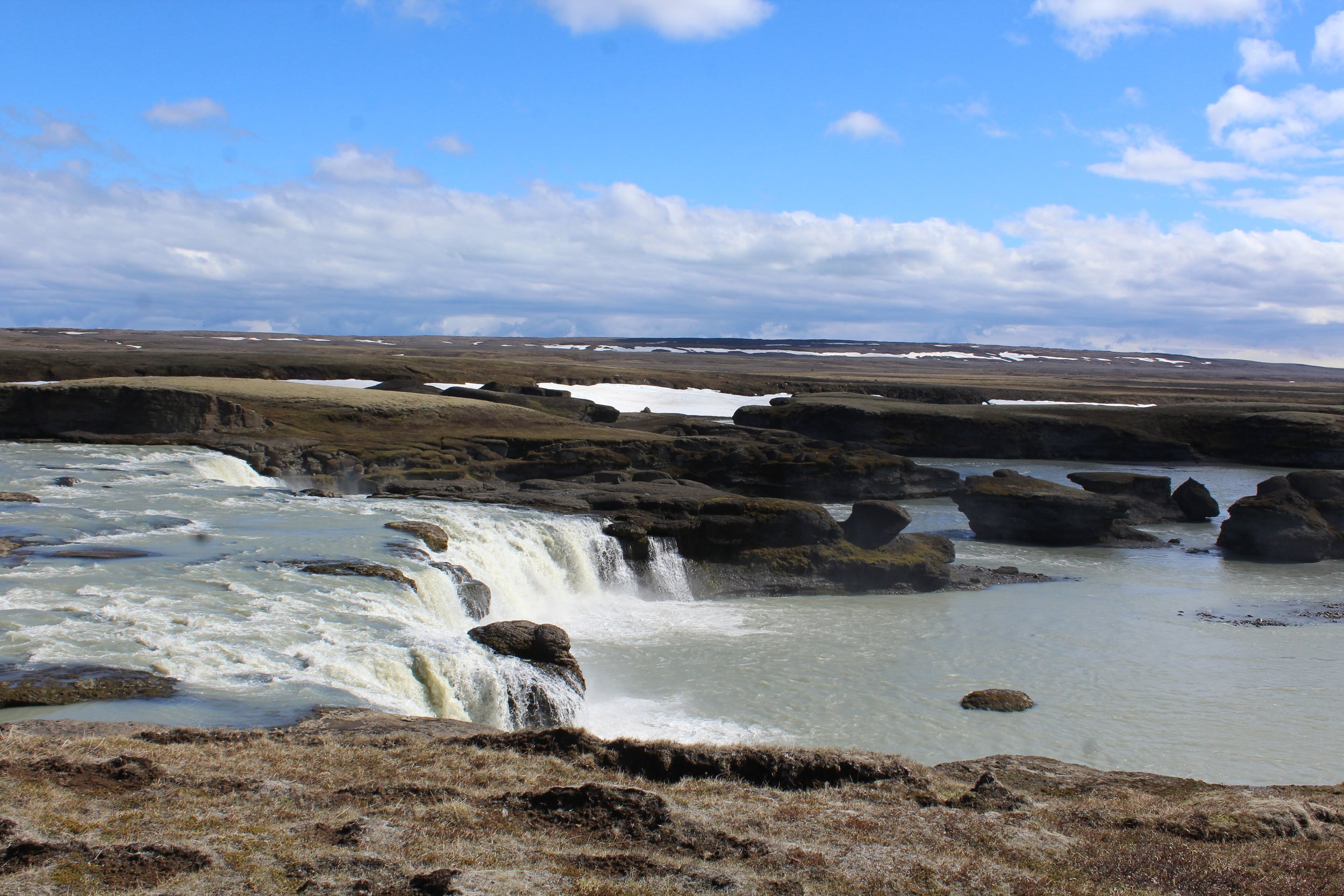
The weir itself has a strong towback and no weaknesses. It is probably best to portage on river left. 5km after the weir a waterfall is obvious on the horizon. There are various lines (some slides) split by small rock islands/towers, but generally speaking the left-hand side looks easier than the right. Land some way above the waterfall on the river left and scramble up ‘sand dunes’ to inspect.
Within 3km (G2-) you’ll arrive at the next waterfall. Again this waterfall can be run but is probably easier from the right hand-side (note the photo on Google Earth by robiswiss@falnet.ch is of Þjófafoss, not this one). Land river right to inspect as it would be difficult to ferry across from the left bank. The first few hundred metres after the waterfall consists of G4+ rapids in a mini gorge. After the obvious crux the rapids quickly get easier and there is nothing else of significance in this mini-gorge. This is not the grade 5/6 gorge mentioned here (which didn’t seem to exist, or as the river splits a bit around here, was a minor side channel we didn’t even see).
Soon after exiting the gorge you will arrive at a third waterfall, Þjófafoss, which will be a portage for almost all groups (supposedly severe criminals used to be thrown over this waterfall for their punishment!). Egress is reasonably simple but finding a way to get back to the river can be difficult due to steep cliffs. We landed on river left but from our perspective river right seemed like the better option.
From the bottom of Þjófafoss the river is at most G2- for 21km until 64.041172°N, -20.154574°W. Here the river splits around an island. We took the right-hand channel, scrambling high on the bank to inspect, which was a 750m G4- rapid. The rapid consists mainly of large wave trains hiding the odd hole. In particular be wary of a large hole covering a large chunk of the right-hand side of the river just before the two channels converge again – you will likely have been pushed right on the previous bend but try and get as far left as possible before the obvious final drop/wave/hole. Overall this rapid is much bigger than it looks when inspecting from the bank!
5km of easy water bring you to the next water, Budafoss (64.03110°N, -20.286935°W). We found this the hardest waterfall to spot from a distance so pay attention – essentially this is the first thing of any significance after the rapid detailed above. If you’re not sure get out and look! Land river left to inspect – the easiest line is probably hard left but portage is also easy.
From here the river remains easy until the obvious narrowing of the river a couple of kilometres above the ring road. This rapid is described here but is essentially a grade 4 wave train rapid through a gorge. The hardest part is right at the start (and can be avoided by paddling right around the rocks) and the river has eased by the time you cross under the old bridge.
From here it is best to stay right as this will allow you to paddle close to the top of the next waterfall with no significant difficulties (both the lead-in rapids and the actual waterfall are far harder on the left-hand side and would not be worth the risk in my opinion). This waterfall is Uridafoss and can run at grade 4 on right river via a series of slides and small drops. Portage is also easiest from the river right bank. There are likely to be tourists at this waterfall so be prepared for some observers!
Being Iceland’s most voluminous waterfall, paddling out underneath Uridafoss is an awe-inspiring experience. From here it is around 20km or so down to the sea along mostly flat and slow-moving water. Winds also tend to blow in off the sea and slow your progress. The scenery for this part of the river is not Iceland’s most exciting, but the likelihood of seals following you down the river more than makes up for it.
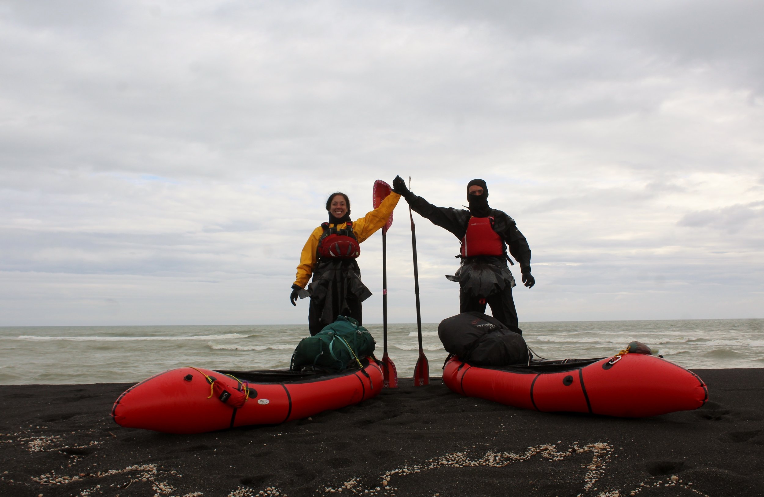
Eventually, by a deserted and desolate blank sand beach, you have made the coast! The waves here and strong and powerful – two experienced Icelandic sea-kayakers drowned at the Pjorsa river mouth in 2017 so it is advised to land in the protected ‘bay’ just before the actual mouth and walk the last couple of hundred metres.
Trip Report
The best photos are courtesy of Neil Irwin
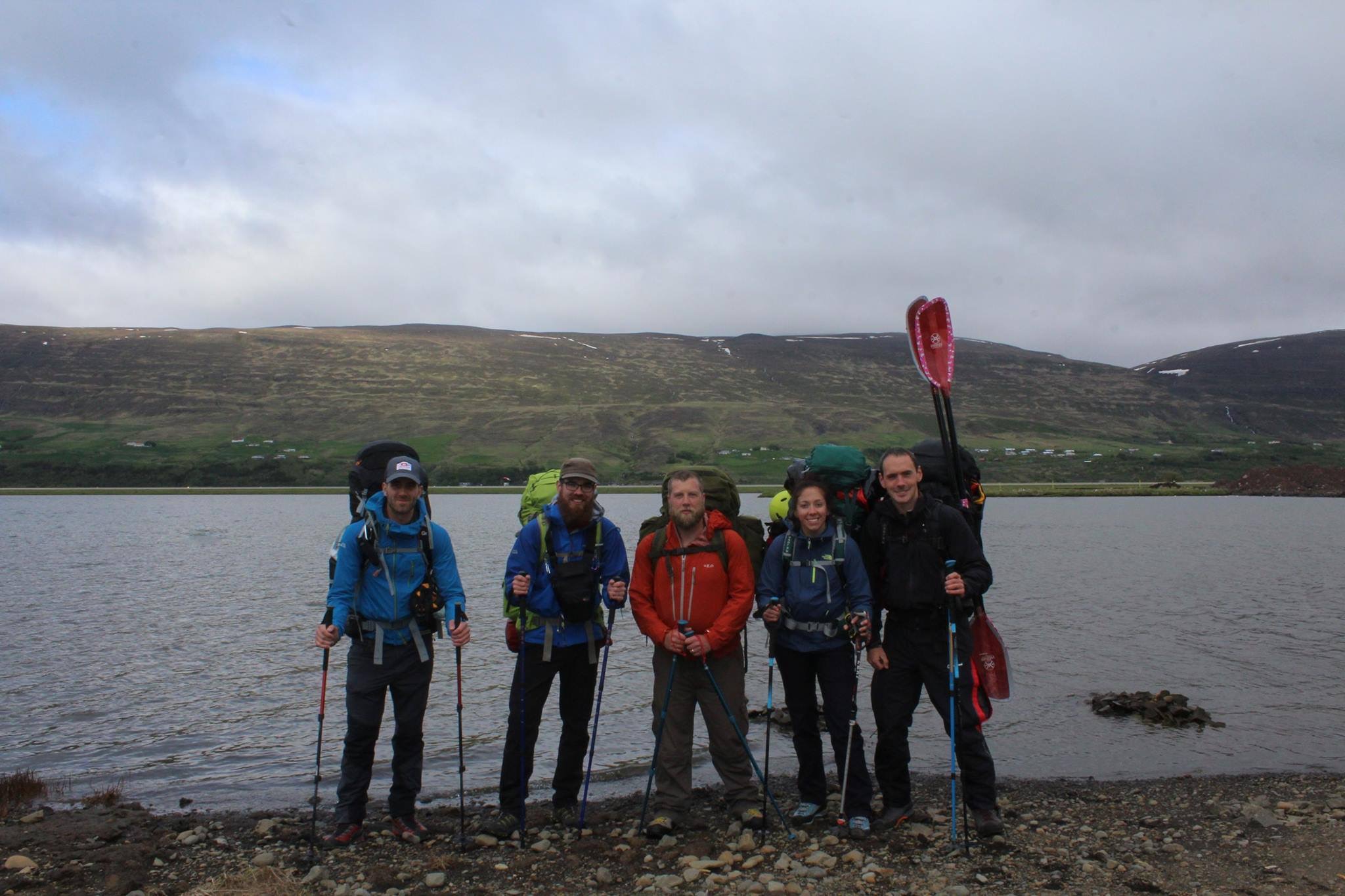
Trip reports from the trek team’s expedition have been written by Ben James and Neil Irwin
Being whipped by horizontal snow at the source of the Þjórsá, Leanne and I looked at each other and wondered if we’d bitten off more than we could chew. We were deep in Iceland’s desolate interior and having just left our friends behind we were now all by ourselves, cut-off from help, and with around 230km to paddle before we reached the North Atlantic ocean.
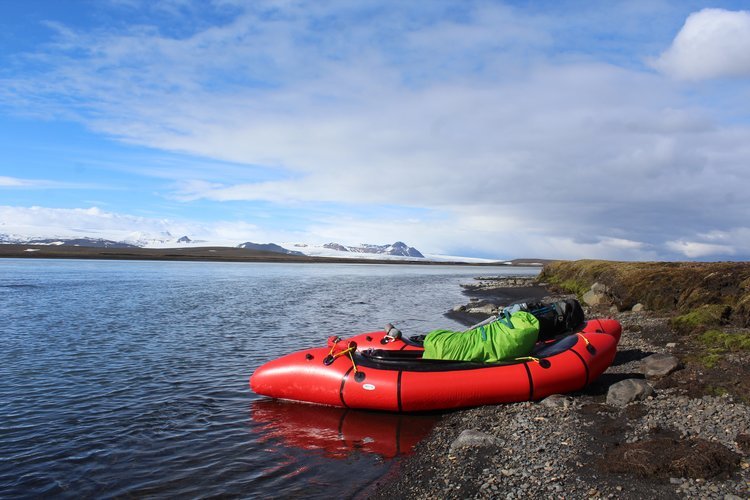
I was nervous; all the other Icelandic packrafting expeditions we’d come across had either had their packrafting equipment delivered to the start of the river, or had mainly trekked and done little packrafting. We were completely unsupported – there would be no resupplies so we were carrying everything we needed to hike, packraft and survive in Iceland for over 2 weeks. We also were attempting to packraft Iceland’s longest river from its source to the sea – we knew there would be a few waterfalls we’d need to portage but we hoped to paddle nearly all of the river and rapids. Therefore we had to have ‘proper’ kayaking kit; there would be no inflatable life jackets and missing helmets like some expeditions, but also we couldn’t afford the weight penalties of carrying our normal kayaking gear.
We ended up settling on a number of lightweight items rented from the Packrafting Store. It was a mixed bag. All of the items were good for their weight but I wasn’t sure I trusted some of them for a pushy descent of an unknown huge volume river. We’d taken the packrafts to HPP (an artificial white water course in the UK) to test them out but the results hadn’t been reassuring – neither of us could really roll the boats in rapids and we’d both taken a couple of swims. There aren’t many people in the world taking packrafts down grade IV rivers, and fewer still doing that with lightweight minimalistic gear and a 15kg bag strapped to the front of the boat. Leanne has only been paddling for just over a year, and this was my first time on a river of this width and volume – I just hoped I knew what I was doing.
We believe this is the first recorded source-to-sea descent of the Þjórsá[1], with Leanne also being the first recorded woman to complete a packraft traverse of Iceland. Icelandic kayakers were also unable to provide any detailed information on the upper sections of the Þjórsá – we were in virgin territory and needed to be careful.
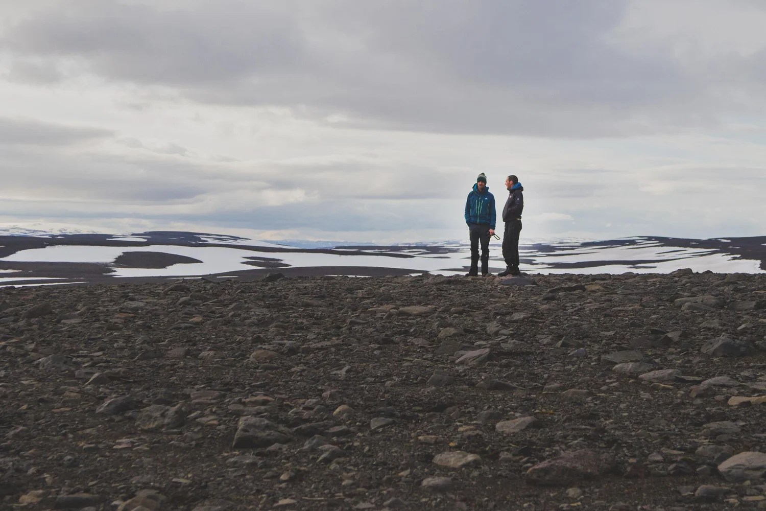
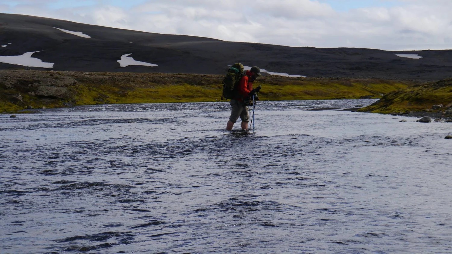
It had taken us four and a half days to walk to the Þjórsá’s source from the coast in Akuyeri. We were accompanied by three friends who were continuing on to complete an unsupported trekking traverse of Iceland. This trek team operated independently in terms of food and equipment but it was encouraging to have their company at the beginning of our trip.
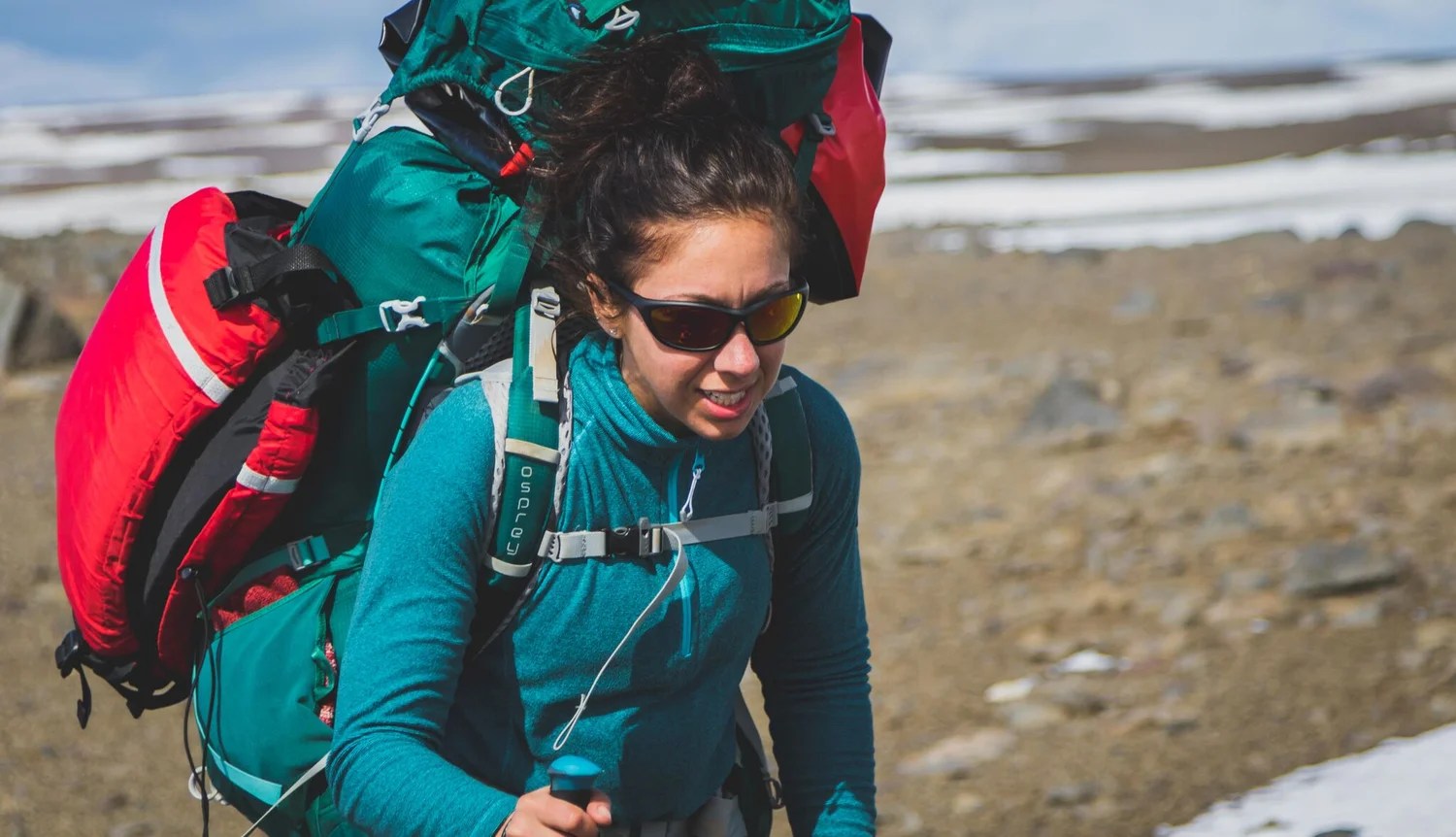
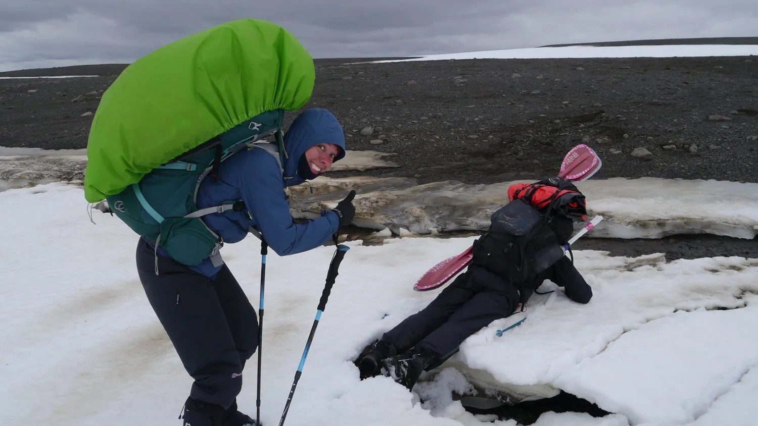
Our packs were heavy (mine was nearly 35kg at the start), crushing our shoulders and rubbing mercilessly on our hips. We hadn’t been able to afford high quality split paddles so I had two 2m paddles strapped to the side of my bag. I couldn’t sit down or easily remove my pack so whilst the others rested I often had to adopt a ‘sprinter starting block’ position as this was the easy way to get the weight off my shoulders and legs.
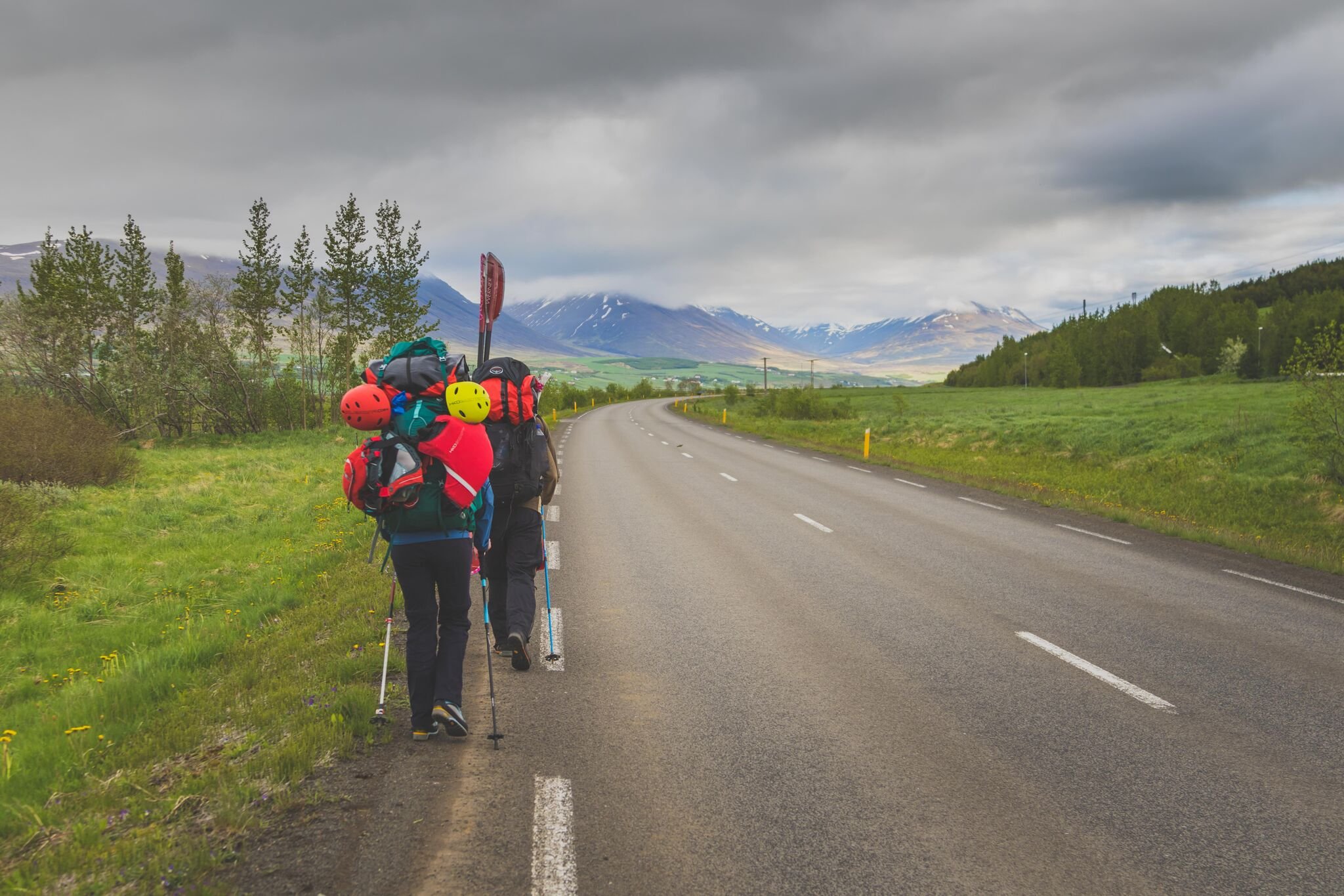
We made good progress on the first day, covering 11km in just 2.5 hours after driving to Akureyri from Reykjavik. Despite the weight our spirits were high, the weather was good and even walking along a road this close to the city felt remote. I’d spent the previous month in England attending weddings, stag dos and wine tours. After 4 months in Nepal the UK had seemed loud and claustrophobic; I relished the lack of alcohol, quietness and simplicity that the pounding of my feet along the F-821 symbolised.
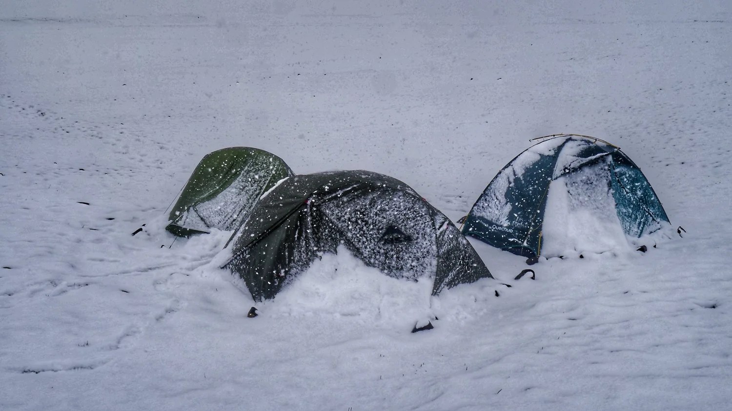
That night the weather turned. The gentle drumming of raindrops that started during the night continued without pause for 16 hours. Breaking camp that morning was a harsh reminder of the trip we had let ourselves in for. After the first 16 hours the rain continued, on and off, for the next week or so. The saving grace was that as we ascended to Iceland’s interior plateau the precipitation turned to snow; colder, but easier to deal with whilst camping.
The idea for Iceland originated from my girlfriend. In a rare moment of guilt I asked her where she would like to visit, as I worried that I kept dragging her about all over the place. She told me that she would like to go to Iceland for the Northern Lights. It was here that my usual personality took over and I ended up cajoling her into a challenging expedition in June.
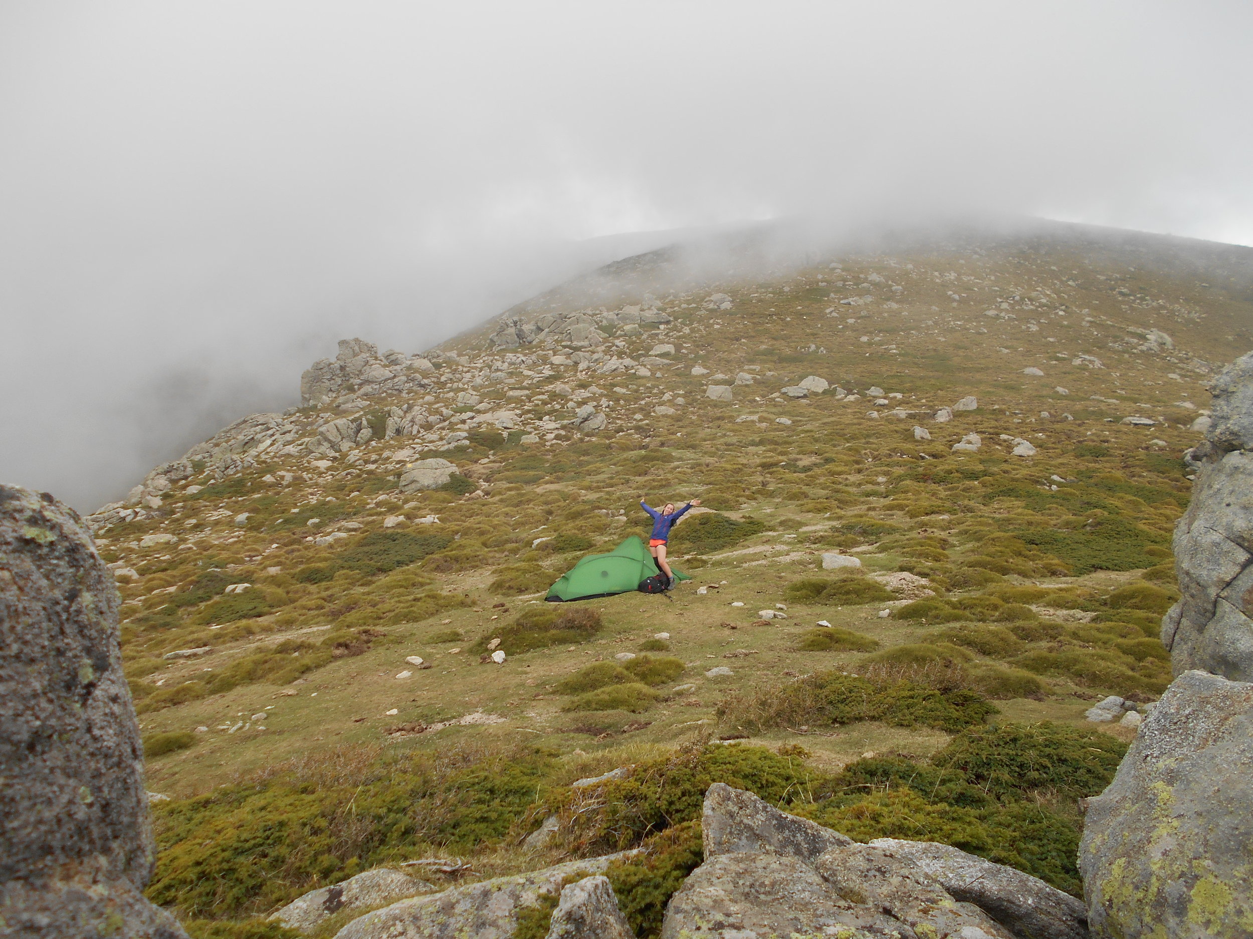
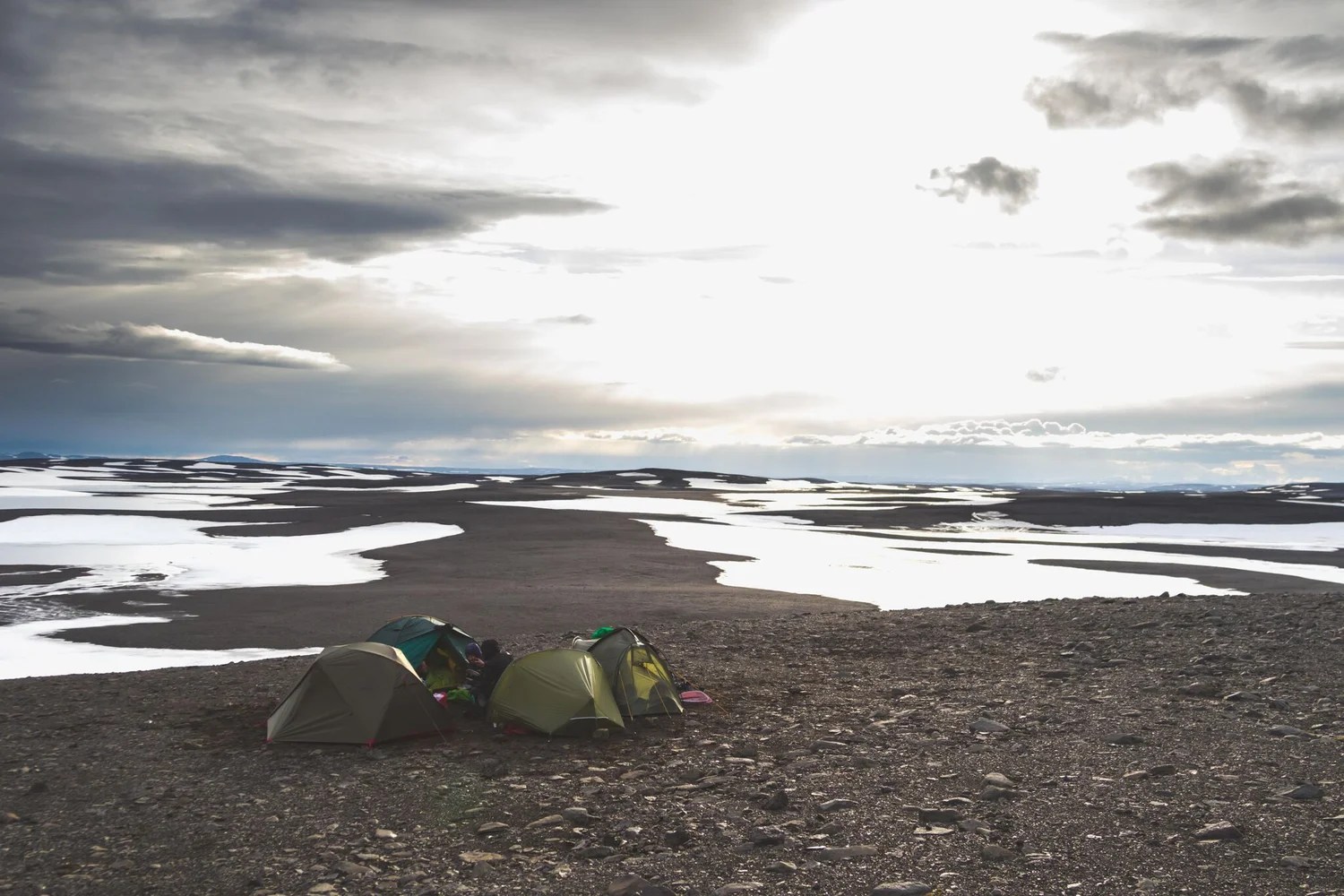
There were no chance of seeing the Northern Lights in 24 hour daylight. In fact, once we’d ascended to the interior plateau there was little chance of seeing any colour at all. Everything was grey. Grey and white, each footstep seemingly identical to the last. All day we looked forward to crawling into our “little orange bubble” (our tent), every morning we would wake up naively believing that the orangeness of the tent meant it was sunny outside.
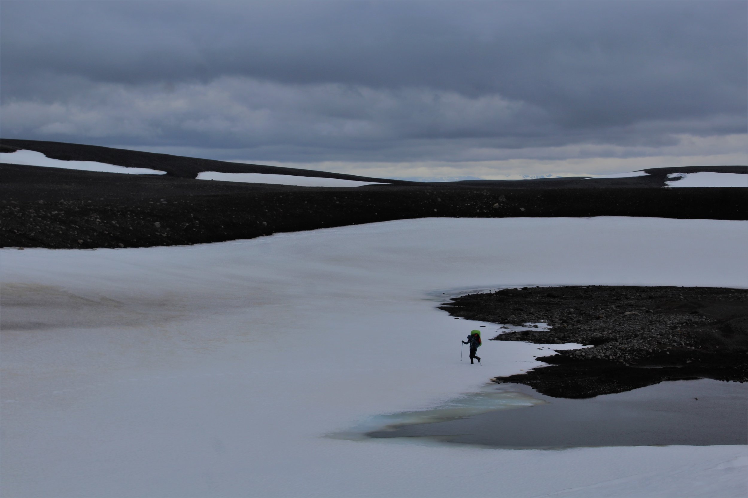
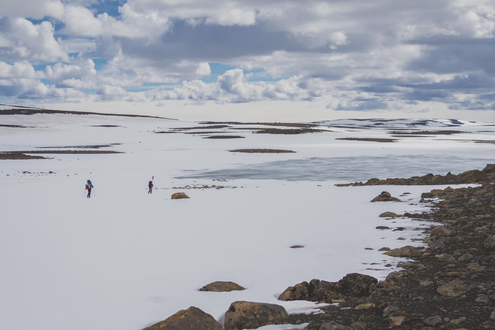
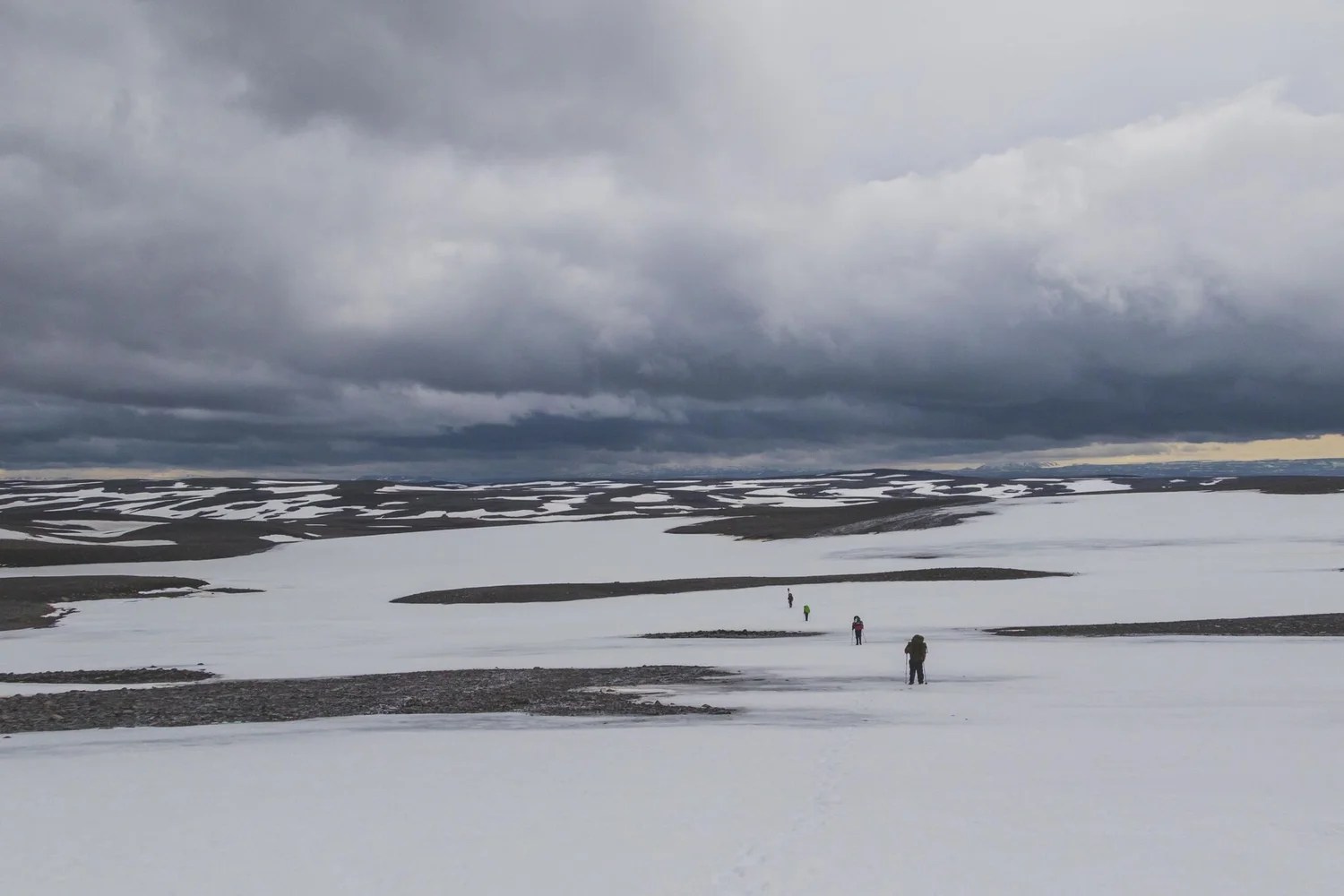
Our speed slowed significantly as we ascended to the interior. We’d travelled out to Iceland earlier than many expeditions would, this was so as to attempt to catch the Þjórsá before the summer glacial melt rose the water levels and the difficulty. However, there had been a lot of late snow in March (and it was still snowing when we were there) so much of the terrain was snow covered. The snow was soft and slushy, we’d often sink to our knees and the risk of a broken ankle from falling through large boulders under the snow was never far from my mind.
We ended up walking far greater distances than we planned, trying to link patches of rock together to avoid the snow. The bottom of many of the mini-valleys we came across in this undulating landscape were completely waterlogged; soft snow would sit on top of a huge puddle of water and the ‘rocky’ ground became what we termed “stony gloop”, a rocky quicksand that sucked you down to your shins. Our progress slowed, each step hard won, ground crawling by at only 2 to 3km an hour.
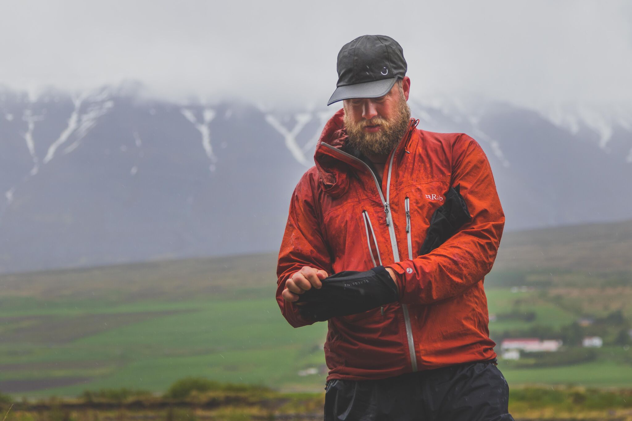
The evenings became a battle to dry out our kit. We’d put boots and clothing out in the wind in dry spells and then dash out to collect it all as soon as it started raining again. I advised the trek team to put dry socks over their wet socks when they went to sleep to dry both pairs out. One of the guys didn’t fully understand this and wasn’t wearing the socks at the time, resulting in everything being wet in the morning.
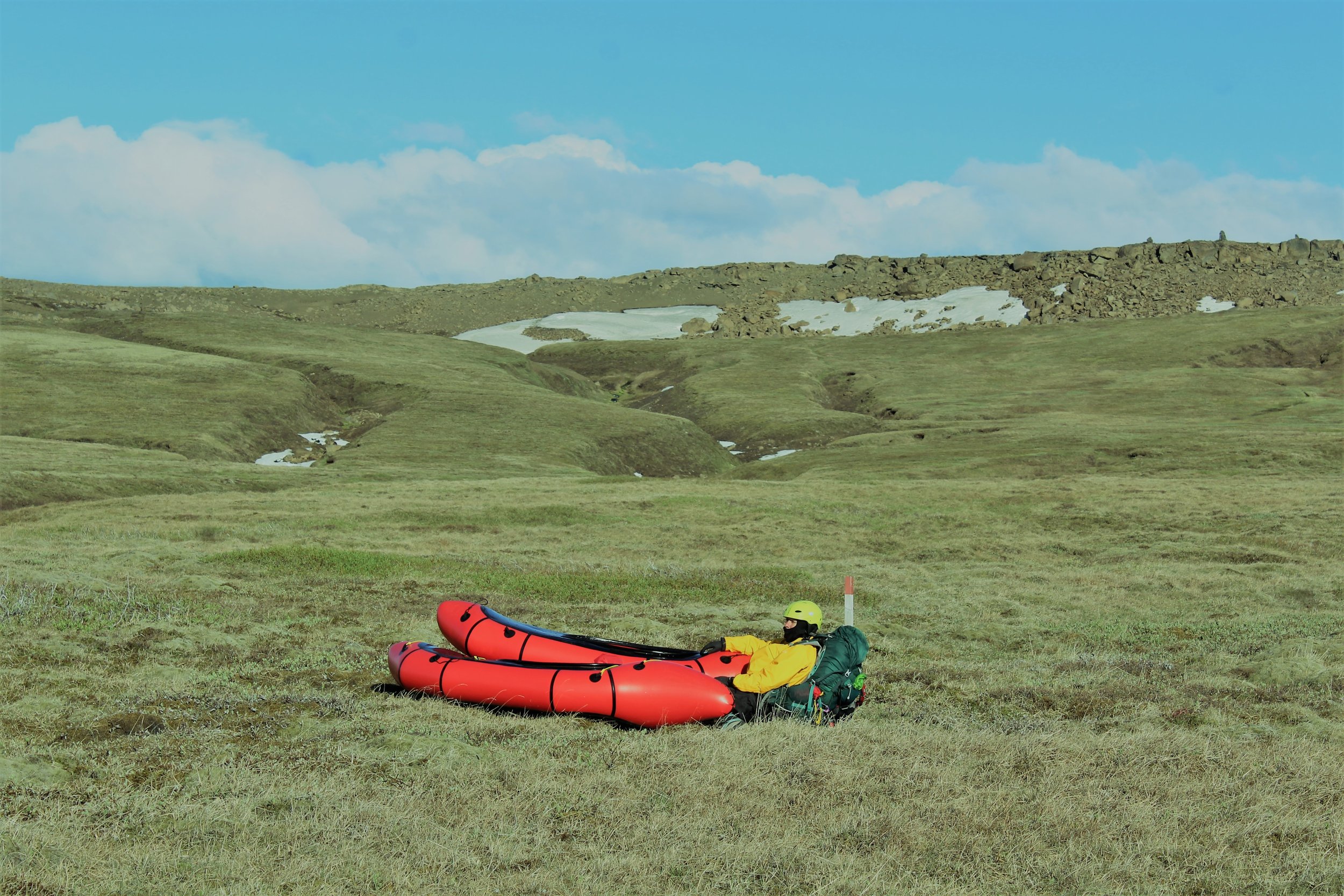
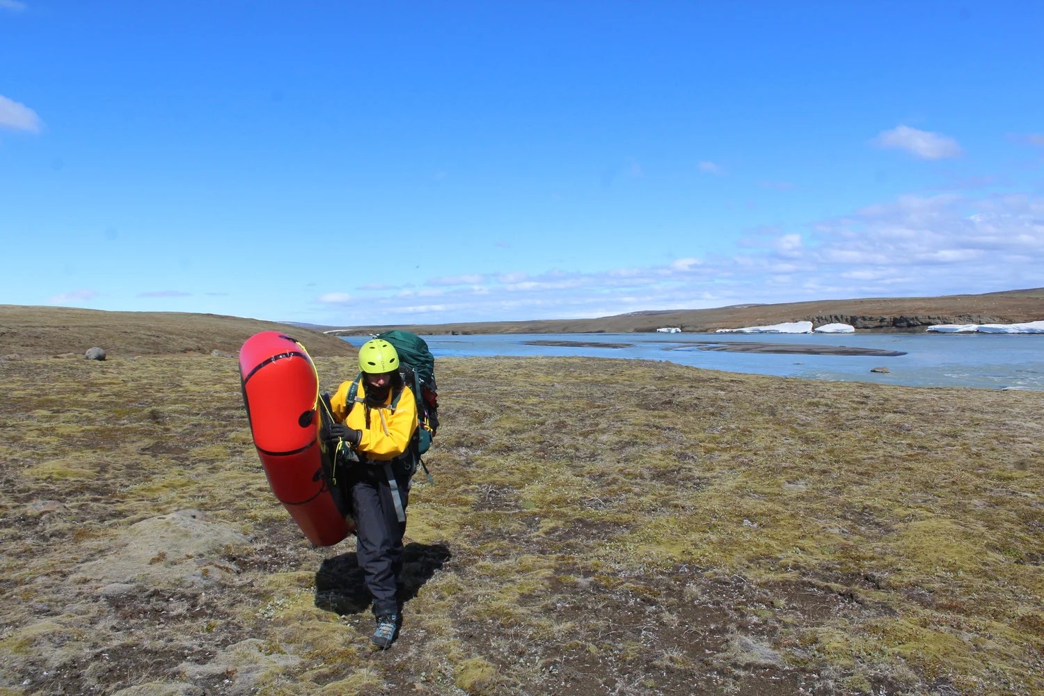
Eventually we split away from the trek team, and Leanne and I started following the Þjórsá on foot until it was large enough to be navigable by packraft. The river was stunning at this point, flowing through snow canyons and under snow bridges. We finished earlier than planned that day, stopping at a point where we thought we would be able to begin packrafting tomorrow. Leanne laughed at my excitement, I couldn’t wait to get back on a river and let the water do the work!
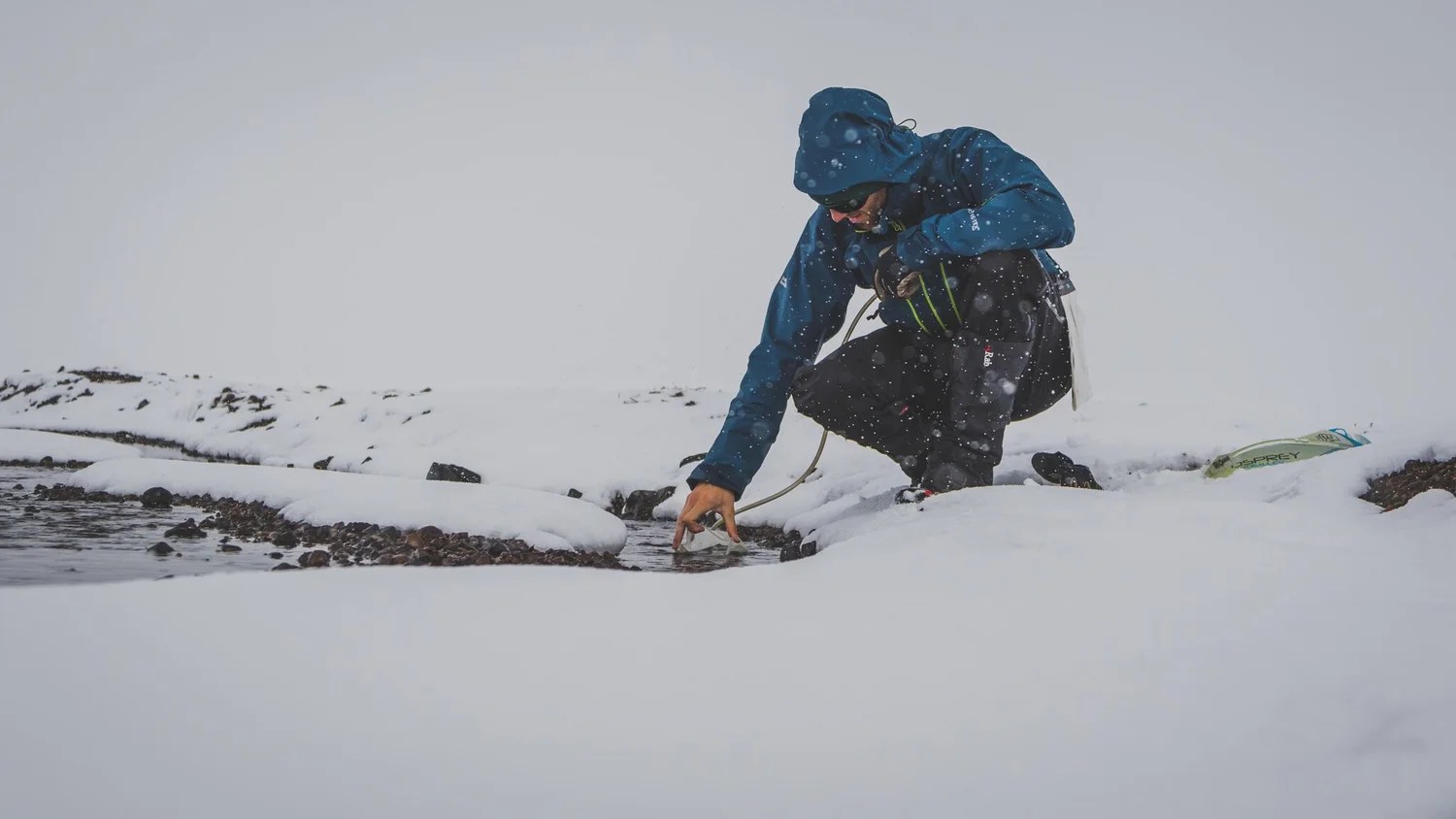
The following morning we awoke to horizontal snow slamming against the tent. We weren’t equipped for these sorts of temperatures. Each of us was paddling in just a t-shirt, thin fleece and thin dry suit. We had no shoes for our feet (wearing hiking boots in white water would be dangerous) and only thin neoprene gloves. That morning we inflated the packrafts and then were trying to strap on the bags and launch from an ice shelf overhanging the river. The shelf took my weight fine, but as Leanne moved to help me, it snapped, plunging both of us and all the equipment into the river! Fortunately Leanne was able to scramble out whilst I held onto all the gear. We didn’t lose anything but we were both already wet and cold and we hadn’t even sat in our packrafts yet!
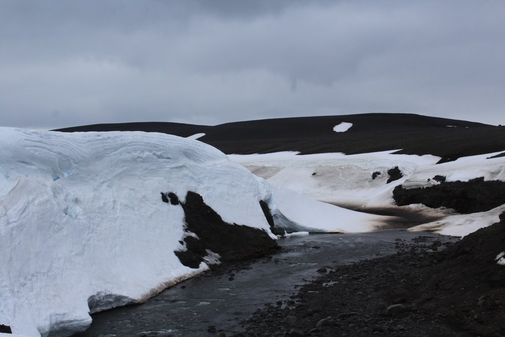
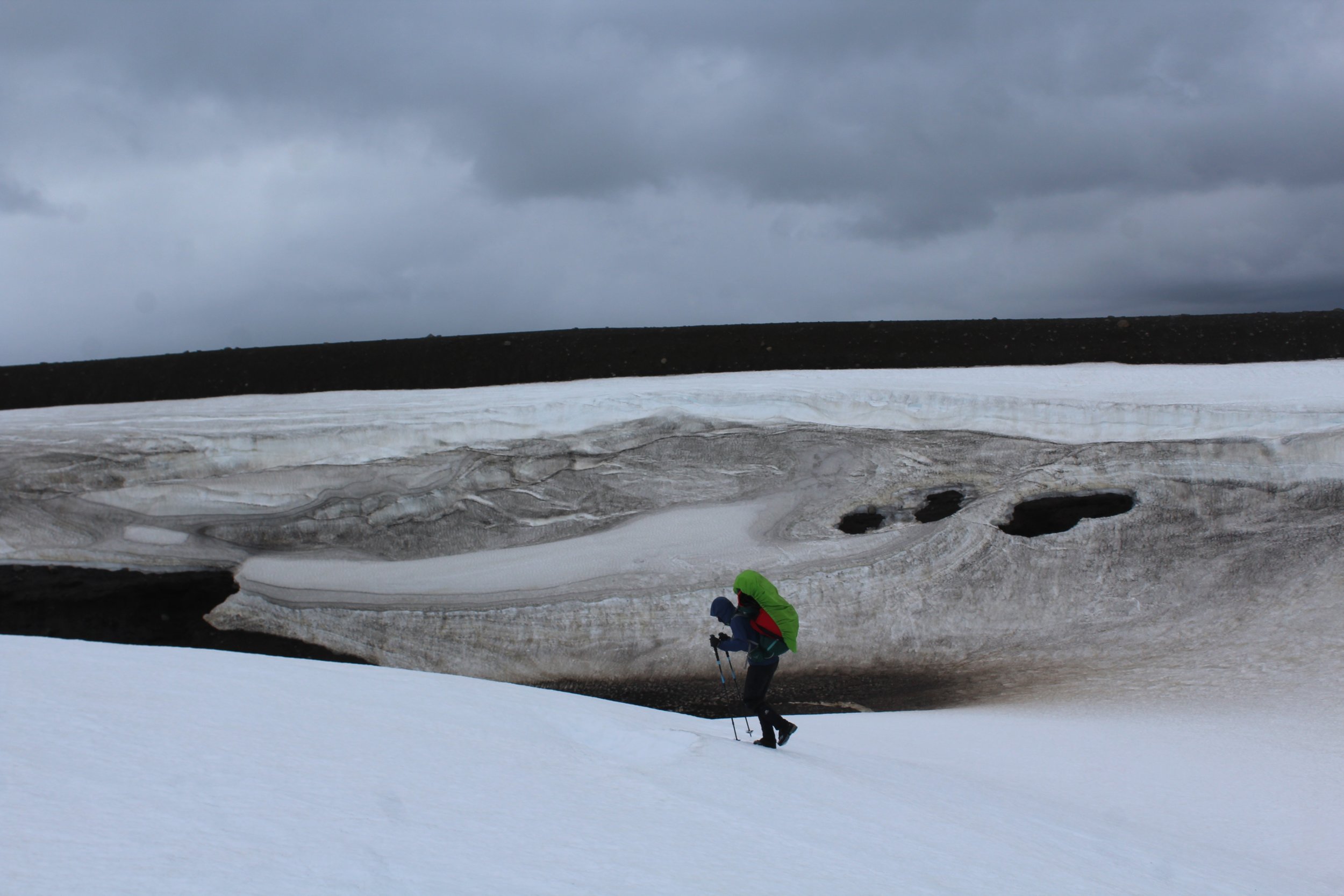
I still don’t know how I feel about that first day of paddling. The scenery was stunning. The river thundered through, over and under glorious snow and ice formations. A mini-canyon contained several waterfalls and drops but sadly most were blocked by ice and so weren’t paddleable. In numerous place the entire river sumped underneath massive snow bridges. In rock this type of river feature is normally called a siphon and is considered highly dangerous – to see so many of them in snow and ice here was beautiful but also very scary! Our progress was very slow, we had to do lots of portaging around these snow bridges and drag our boats through shallow areas. Portaging a packraft is actually surprisingly difficult, particularly when strong winds are threatening to blow you over and fling your boat into sharp rocks.
After covering about 2km in 3hrs we decided to give up. We’d got on the river too early and it wasn’t really navigable at this point. Blocks of ice floated past and we were dangerously cold; both of us were shivering violently and neither of us had been able to feel our hands or feet all day. We packed up all the paddling gear and started a brisk walk, following the rivers course to cover some distance and try and warm up. Walking along the river we realised this was the right decision, only very short parts of it were deep enough to packraft so trying to do it by river would have probably taken another couple of days.
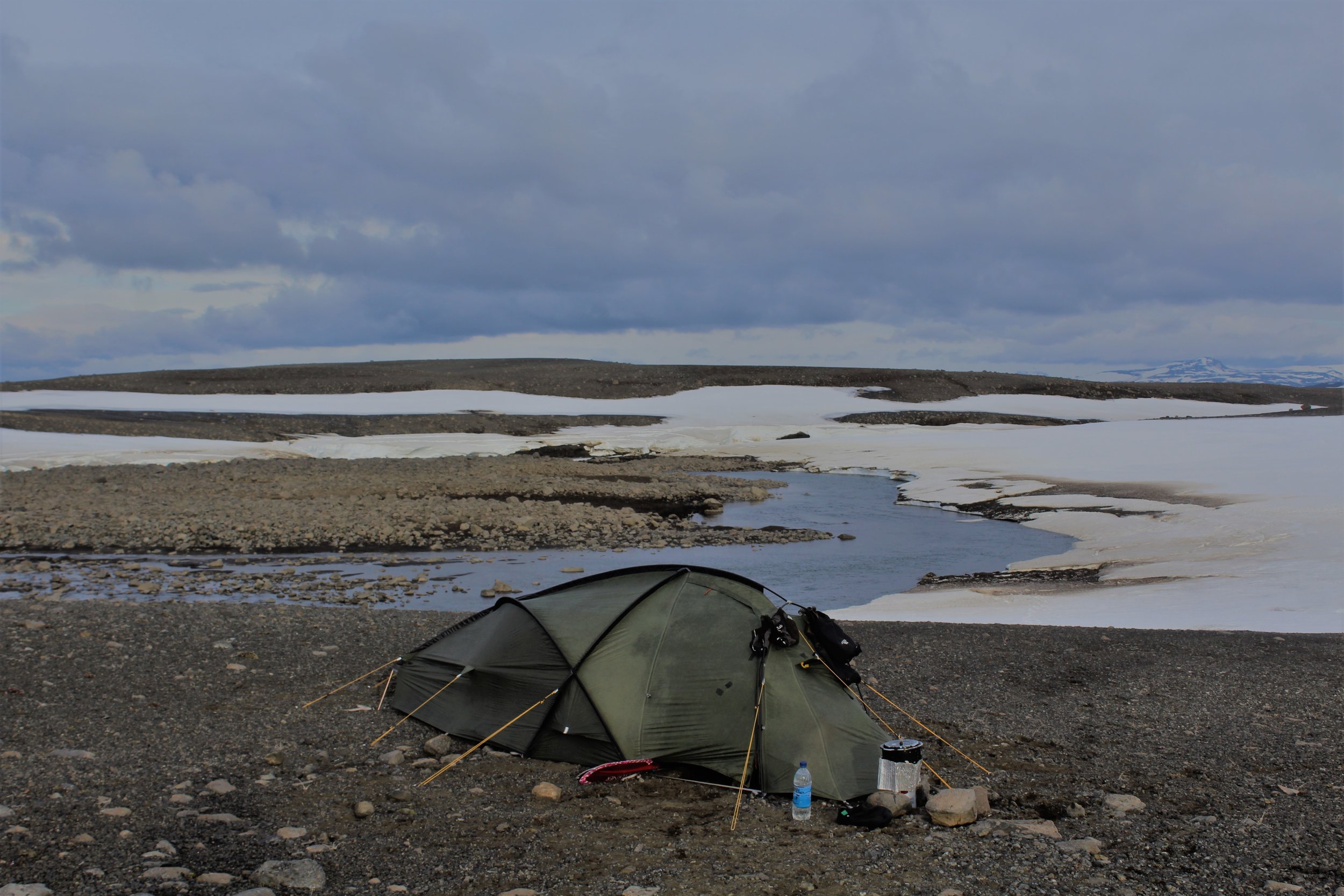
We reached a confluence with another similarly sized river and decided to spend the night here, believing that the river would be navigable beyond this point. Snuggled up in our tent that evening we called up a weather forecast on our InReach device; it showed moderate snow and strong winds for the next 3 days. We’d been battered and bruised by Iceland that day and despite our best efforts were still behind schedule. The weather forecast wasn’t encouraging, and I think we both went to bed that night doubting our resilience to continue with the packrafting.
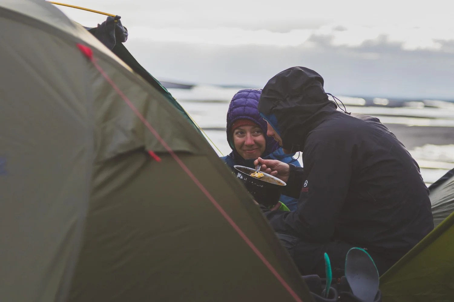
But we persevered. From here nearly all of the river was navigable to the sea. We portaged round some of the waterfalls, and there was one short section after a dam that we had to walk due to lack of water. But each day felt colder than the last, and even though the weather improved as the days became sunny and clear, our calorie deficient diet simply meant that our bodies didn’t have the fuel to keep us warm.
On a third day of packrafting we came across the first big rapids. By this stage we’d played around with our outfitting more, had dispersed our kit weight better around the packraft and had learned how to attach the bags securely. This last improvement was particularly important as the bags had come loose on the smaller rapids upstream, and a heavy bag dangling in the water halfway down a big rapid would be a sure-fire recipe for disaster. We were more confident in the boats now and cruised the class IV with only one short unlucky swim. Chase boating Leanne’s packraft I realised that it would be almost impossible to roll the packrafts with the bag attached – once capsized the bag acts as an anchor holding the boat upside down and I struggled to right it even from my kayak. Sadly I hadn’t charged my GoPro properly the night before and so we have no footage of these first large rapids that we tackled.
The current was surprising for a river with so little gradient. You had the feeling of being whisked along by a powerful force. The river was extremely wide in places and leading was challenging. Many of the rapids were committing through mini-gorges and with few eddies it was difficult to inspect lines. Despite my usual confidence I doubted myself and wondered if I was up to the task. But we carefully threaded our way down the river, managing to paddle loads of good class III to IV/IV+, including some of the waterfalls.
We joked about taking a sunny holiday somewhere pleasant, maybe scuba diving or sailing in the Mediterranean. What is it that drives us to take on these challenges? Why not have the kayaking kit delivered or stash food supplies in advance? For me I think it is the purity and the challenge; I enjoy the feeling of being self-sufficient and having the physical capabilities to do so. On one remote trip I was on previously batteries and food supplies were dropped off almost daily by motor boat. I remember lying in my hammock in the mornings, taking in the sounds of the birds and animals, only to be disturbed by the sound of a motor engine cutting through the trees. For me adventure is escapism; a chance to avoid reminds of the real world. I’d happily use resupplies and stashes if I needed to, but generally I find them an all too soon reminder of the real world and what I have to return to.
Gradually we dropped height and the grey gave way to greens and purple. Iceland gradually came alive as first insects, then birds and finally horses arose on the horizon. It was odd really as we hadn’t noticed the lack of life but for the several days we’d been in the interior there had been nothing. No trees, no plants, no animals. One thing that really struck me about Iceland was the lack of litter. Even when we were near roads of more populated areas we never saw rubbish in the river or along its bank. It was a refreshing change from Nepal, and even from many areas in the UK.
One of the highlights of the trip from me was paddling beneath the Hofsjökull glacier. The sky was clear and the sun was shining brightly, glistening of the glacier and surrounding mountains. This glacier is only the second largest in Iceland, but it is by far the biggest and least crowded (there were no people on it!) that I have ever seen. It felt slightly surreal to be paddling beneath it knowing that nearly all the water of this vast river originated from this great ice giant. My main regret from this trip is how little time we had; it would have been brilliant to have taken a day or two to check out the glacier and potentially climb one of the peaks.
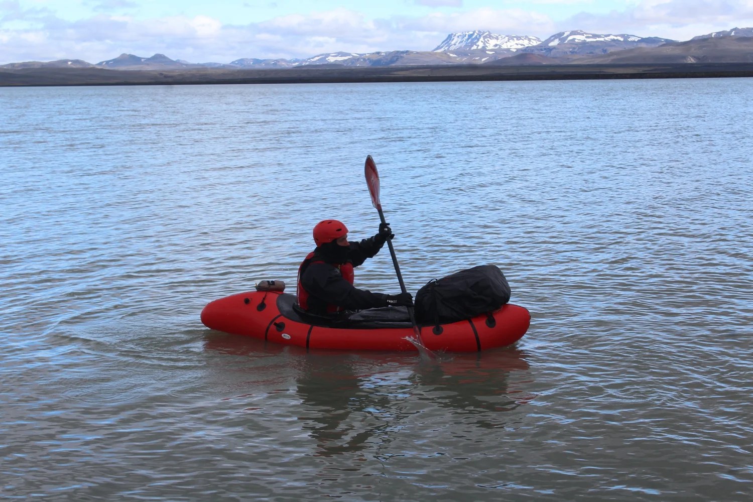
One day we crossed a lake dammed at one end and saw a small innocuous looking whirlpool that we soon realised was the source of a 300 cumec discharge (that’s the equivalent of a 25m swimming pool of water passing you a second) just a few metres away. Putting on the other side of this dam was exhilarating; there was big powerful water and waves created by the discharged which we knew weren’t going to lead into any scary rapids.
The scariest moment for me was making a decision to run Budafoss, one of the many waterfalls on our river. Internet sources state that it is 10m at its highest point but I ran a far left line which was a double drop and is probably a little lower in total anyway. The rapid and waterfall wasn’t that difficult if I stayed left. However there was a risk of being pushed right into a dangerous and inaccessible area which could easily drown me as it would very difficult, if not impossible, for Leanne to affect a rescue.
Due to the risk I’d removed my rucksack from the front of my boat for this rapid (the only time I felt I needed to do this) to give me more control. I managed the lead-in rapid fine and hit the first drop exactly as I wanted. However, I’d ripped a hole in my boat the previous day and the patch was still leaking air. Either the rip, or the general design of packrafts, resulted in the boat folding and the spraydeck popping off.
Strangely it is situations like these that are some of the moments I love most about kayaking. Kayaking is very dynamic, often you only have split seconds to make a decision and go with it – indecisiveness is not an option. I had two choices here; one was to try and turn hard left and slam into some rocks that might pin, turn or slow me enough that I could then make my way to the bank, the second was just to paddle the drop without a spraydeck. The first option ran the risk of me not making the bank and ending up being off line, sideways or backwards for the final drop.
When I teach people to kayak I think the best one-line piece of advice I can give them is “don’t get scared. If you see something and don’t know what to do then point forward and paddle as hard as you can. Don’t lock up”. Obviously there are times you need to stop but for a kayaker speed is your friend; if you’re committed to a rapid or feature more speed is very rarely going to cause you problems.
This thought went through my mind in the second I had to make my decision. I committed to the second drop, shouted to Leanne that my spraydeck had blown and paddled forward with everything I had. I knew I was on-line and so wasn’t going to be pushed right above the drop so I should be ok so long as I didn’t get flushed right at the bottom. I lined up at the lip of the waterfall and launched off. I hit the water, my boat promptly filling with water and sinking, dragging me down with it. With no spraydeck and a half-inflated boat I was immediately ripped from the packraft. From the video you can tell I was underwater for about 5 seconds total; this may seem brief but when you are being pulled downwards by a powerful force, with no idea of how long you will be underwater or how bad the situation will be when you surface, then it feels like a very long time. I was lucky, I wasn’t flushed right at the bottom (which would have been unlikely anyway) and Leanne was ready when I briefly surfaced with a perfectly co-ordinated throw bag rescue.
I was surprised by my boldness on some of these waterfalls and rapids. There is no way I would have run them prior to Nepal and here I was attempting them in a packraft. Was it reckless? Or has my ability improved? Was it right to be leading my girlfriend into these unknowns? We’d packed carefully and tried to minimise the risk. She carried my clothes and I carried hers so that if someone took a swim and lost a boat the wet person would have dry clothes. She had the mobile phone and GPS for walking out if needed, I had the InReach device and compass. Our food and sleeping gear was split between the two boats so that we could survive if we lost one. I’d scout ahead solo, usually by boat but sometimes on foot, when I wasn’t sure but the nature of the river was that sometimes I’d be committing her to rapids in gorges without knowing how hard they’d get. Nothing went seriously wrong so hopefully we got the balance roughly right, but it would only take one small mistake for a much worse situation to have arisen.
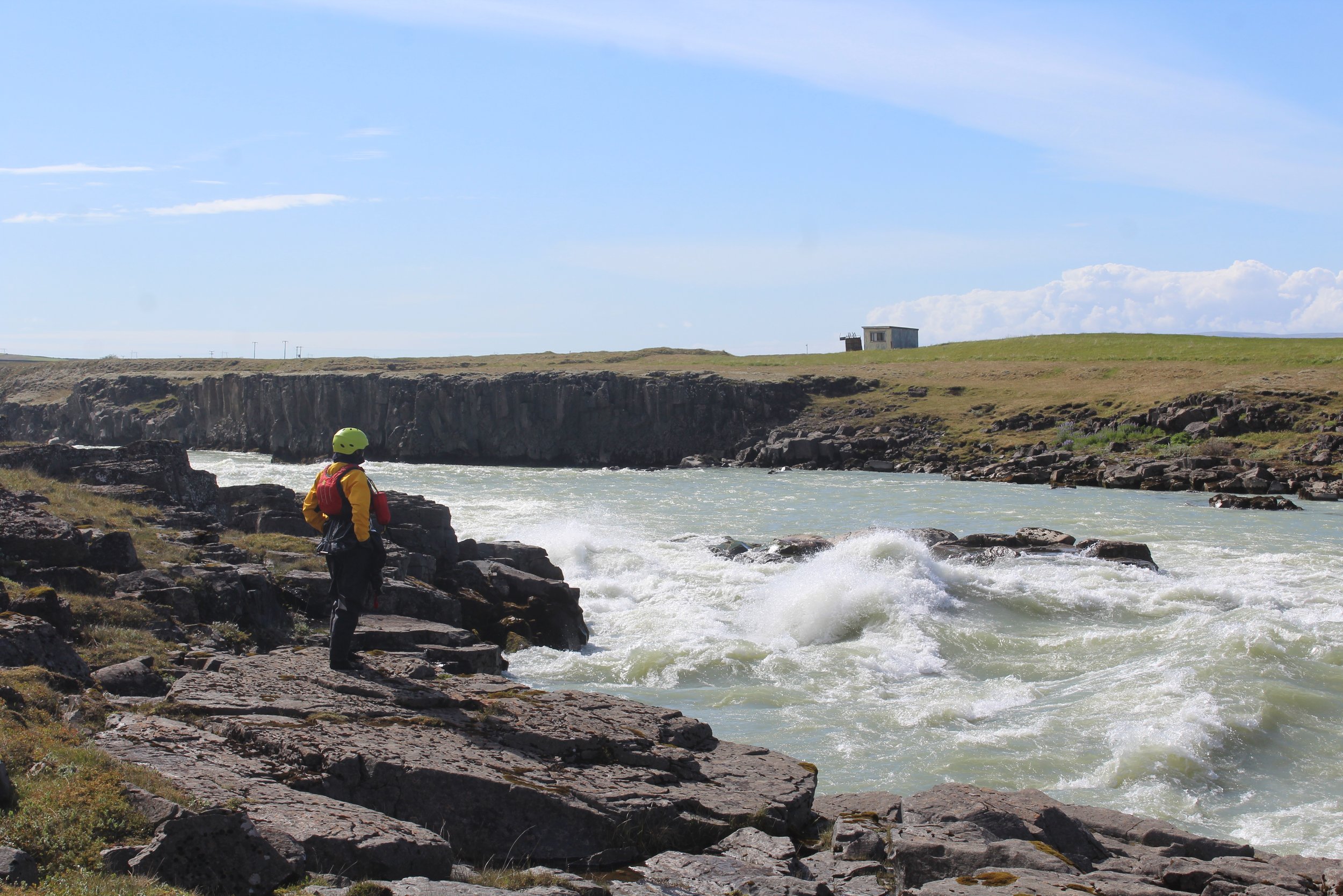
That situation nearly came about on the final rapid of the river. Just above route 1, Iceland’s ring road, the Þjórsá accelerates into a narrow class IV gorge. Waiting at the bottom is Uriðafoss, Iceland’s most voluminous waterfall. Leanne and I actually inspected a lot of this gorge by foot, the first time we’d felt then need to walk more than a few minutes from our boats whilst inspecting. Seeing that the hardest rapids were at the start we decided to run the gorge, rationalising that we would have time to effect rescues before the waterfall if needed.
The gorge started well and we were into easier class III waters when Leanne capsized. I helped guide her into the banks and then peeled off to chase boat. Was this a wise decision? What would be the worst case scenario if I’d just let the boat go? Breaking out into the current I immediately capsized. I attempted to roll but the waves and the weight of the rucksack on my boat meant it was never going to happen. A second later I was in the water as well, desperately swimming for the bank.
We eventually managed to collect all our equipment back together. We’d only lost a rucksack raincover between us and our triple drybagging system had actually kept everything important dry! We decided to put back on above Uriðafoss where my boat had been washed up and paddle the last kilometre or so to the waterfall, which I also decided to run.
Below Uriðafoss the river was almost entirely flat and braided out into many channels as it neared the sea. The weather had turned and we were getting very cold again. After the adrenaline high of the waterfall and the swim yesterday it was difficult to find the motivation to paddle this cold monotonous sections. As we grazed over sand banks and admired playing seals the mouth of the Þjórsá finally came into sight. It had been a long and challenging trip. It had been harder than I expected but we’d also managed to paddle more of the river than I’d initially anticipated. It was cold and windy on the coast but that was fitting, we’d have it no other way. It was over, our journey’s end.
A couple of days after we finished we heard that the trek team had also reached their goal of trekking across Iceland unsupported, and were now some 100km further west of us along the coast – a big congratulations to them! A big thank you also to Leanne for being a wonderful expedition partner and making me laugh when I was at my lowest.
It was great getting the chance to develop my kayaking skills on this expedition. The width and style (waterfalls!) of the river was new to me. Both Leanne and I also found the packrafts took some getting used to. We can understand the benefit of them and they handled much better than I first expected but our inability to roll them is a concern. We only had rental boats though so if we owned our own we would spend more time outfitting them better to improve the internal straps and padding so as to make rolling easier.
I normally tell people to give stuff a go but Iceland is probably not the place to learn to kayak or packraft. It is cold and remote and rapids can all too regularly end in dangerous waterfalls. But Iceland is easily accessible from the UK and if you’re looking for an adventure and have some experience then there is definitely the possibility to string together some exciting packrafting expeditions on rarely paddled rivers.
[1] The source of a river in kayaking terms is normally defined as the furthest place in that river from its estuary or confluence with another river, as measured along the course of the river. We understand that other Þjórsá expeditions started further down the river, where water from the Hofsjökull glacier, the major source, joins.


Leave a comment